Compliance made easy,
Verify Your Chain.
EasyTrace provides real-time satellite intelligence and automated risk assessment to ensure your global supply chain meets EU Deforestation Regulation (EUDR) requirements.
Automated EUDR Compliance Intelligence
We combine high-resolution satellite imagery with advanced AI to automate the most complex parts of the EU Deforestation Regulation monitoring.
Satellite Monitoring
Sub-meter resolution imagery refreshed every 48 hours. Detect even the slightest canopy disturbances automatically.
Legal Compliance
Validate land tenure and legality indices across multiple jurisdictions. Stay ahead of evolving regulatory frameworks.
Risk-First DDS
Automated Due Diligence Statements with verifiable evidence, ready for submission to regulatory bodies with one click.
From Ground to Governance
Four simple steps to total EUDR compliance, powered by planetary-scale data.
Map Your Source
Upload your farm polygons or coordinates. Our system automatically validates the geometry and assigns it a unique global ID.
Deep Satellite Scan
We analyze historical data back to 2020 using multi-spectral satellite imagery to detect any signs of land conversion.
Automated Risk Scoring
Our AI combines forest data, legality indices, and social indicators into a single, verifiable risk assessment score.
Submit & Export
Generate your official Due Diligence Statement (DDS) and share it with downstream partners or regulators instantly.
Technology for a Carbon-Negative Future
By making compliance effortless, we encourage sustainable land management practices across millions of hectares of tropical forests.
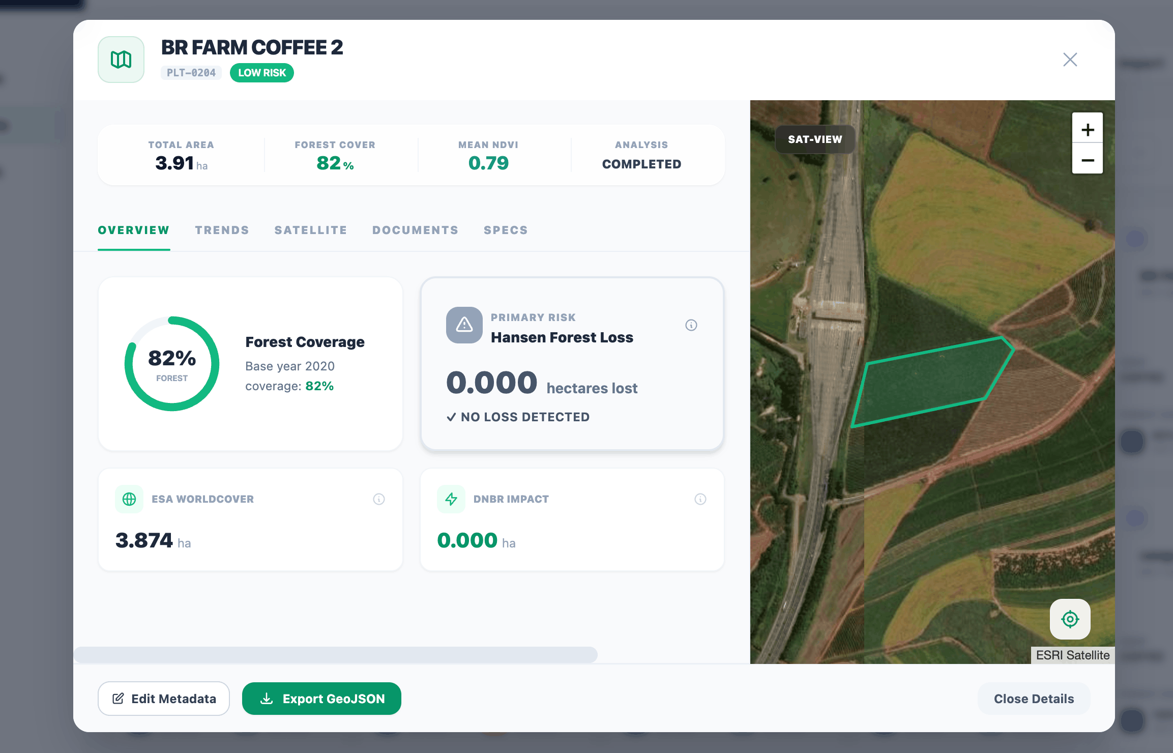
Mapping an EUDR-Compliant Future
Visualize your entire EUDR-ready supply chain on a single interactive map. Track plots from farm to factory with immutable proof of origin.
- Interactive Plot Geometry Management
- Historical Forest Loss Analysis (JRC & Hansen)
- Automated Risk Flagging & Alerts